"The owner of this Apple Watch has taken a hard fall and is not responding to their watch. The emergency location is latitude 47.7, longitude -117.5, with an estimated search radius of forty-one metres."
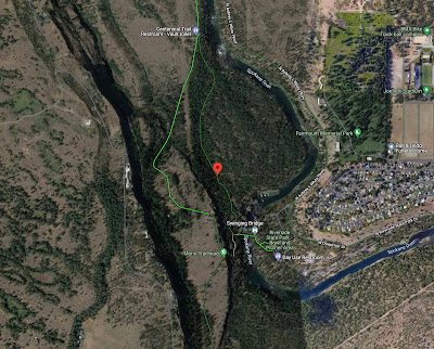
Bob B. (presumably no relation to the unfortunate Amanda A. who flipped her car in fast-rising, muddy water) was knocked unconscious mountain biking in a forest just west of Spokane WA with his watch supposedly making the 911 call. No doubt countless targets of the advertisement will ask Google Maps for the location of the coordinates:
Wow! Exactly on a bicycle-friendly road in a wooded area. But there is something amiss. To achieve such pin-point accuracy one needs precision somewhat beyond the given tenths of a degree latitude/longitude. 47.7000 N, 117.5000 W would do it, although the 41-metre search radius suggests 47.700 N, 117.500 W is probably sufficient. A GPS location is likely given in degrees/minutes/seconds (not decimal degrees) and this would have the desired accuracy. I am not acquainted with the Apple Watch emergency-call GPS specifics but I will point out that by approximating the location as 47.7 N, 117.5 W (dropping the terminal zeros), it implies an error box of ~7.5 km east-west and ~11.1 km north-south. That's a search-area of over 8300 hectares! Poor Bob.
 |
| 47.7º N, 117.5º W, approximation error box (in magenta), click to enlarge |

No comments:
Post a Comment