I've been attempting to fix (in both Apple and Google maps) Weston's misplaced businesses for many years now. Because Weston has some five streets that duplicate, in whole or in part, Toronto street names, it has been relatively easy for a Toronto business that does not know its exact address or postal code to end up in Weston. The exact address and postal code can generally be found using Google search and that information can then be fed to the respective platforms. Occasionally work is also required in the pin placement of buildings, as Google's AI will often guess position on the basis of the street number and the actual site may be some distance from the street. This was the case, for instance, with Weston Lions Arena which has an address of Lawrence Ave W but is actually off Hickory Tree Rd.
Less successful has been my attempt to correct a Google Map path artifact:
The green dashed line on the south side of Denison Rd E represents a path running from the old section of Denison Rd E (which although now an adjunct of the new underpass section retains the same name) all the way to Jane St. An examination of the path in Satellite shows that it is just the south sidewalk of the street. On April 24 of this year I let Google know that the path was superfluous by first selecting it and then choosing "road does not exist" from the informant options. Google's use of "road" here is unfortunate because what I selected was the path — not the road. Likely whoever looked at my recommendation decided that Denison Rd E did in fact exist, so my suggestion has not, to date, been acted upon. I have also coloured magenta, in the above, a building outline artifact that I believe was a temporary workers' shelter while the underpass was being built but is obviously no longer there.
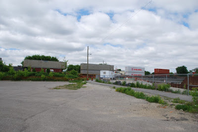
Google's own street view imagery archive shows how the street appeared prior to the underpass construction:
 |
| looking east, June 2009 |
During construction of the underpass, there were (at differing times) three paths for pedestrian traffic. The first meandered on the south side of the project from the Ethiopian Orthodox Tewahedo Church to roughly where the Life Community Church is now (but across the street):
 |
| path 1, looking west, June 2014 |
 |
| path 1, looking east, August 2014 |
The second path was what was to become the north sidewalk of the underpass:
 |
| path 2, looking east, September 2014 |
The third path was what was to become the south sidewalk of the underpass:
 |
| path 3 (behind the fence, left), looking west, June 2015 |
It is this third path that seems to have been immortalized by Google Maps. I'll point out that the east section of Denison Rd E was never under construction, so to have the path go all the way to Jane St shows that Google never really understood what was happening here.


